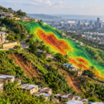





Satellite-derived water and landscape measures helped a machine-learning model predict malaria prevalence patterns in Karagwe, Tanzania. The model showed moderate accuracy rather than clinical diagnostic performance.
What researchers studied
Researchers combined environmental satellite and geospatial information from 2020 to 2024 with malaria prevalence estimates for children aged two to ten in Karagwe District. The malaria outcome was Plasmodium falciparum parasite prevalence from the Malaria Atlas Project, rather than individual clinical diagnoses collected by the study. Inputs included rainfall, surface temperature, vegetation, several water and moisture indices, elevation, slope and distance to water. The team compared Random Forest regression and XGBoost, using spatially structured validation to test how well patterns generalised across locations.
What they found
XGBoost achieved a mean coefficient of determination, or R-squared, of 0.551 under nested spatial cross-validation. Its reported root mean square error was 1.409 and mean absolute error was 0.994 in the study’s outcome scale. The Normalized Difference Water Index, a satellite-based measure related to surface water characteristics, contributed 42.61% of the model’s reported relative predictor importance, with elevation also influential. These are predictive model metrics and importance rankings, not estimates of how much water conditions cause malaria transmission.
What it means
The findings point to a potential way to support malaria surveillance where routine measurements are sparse. Environmental maps could help public-health teams identify areas warranting further investigation and better target field surveillance. However, a model estimating local prevalence cannot replace testing, clinical assessment or direct mosquito and parasite monitoring. Its practical value would depend on timely data, local calibration and independent evaluation before deployment. The work also illustrates how combining multiple satellite sources can provide information about geographically varying disease risk.
Important limitation
The analysis is geographically specific to one Tanzanian district and relies on modelled prevalence estimates as its target. Environmental correlations may not remain stable when interventions, land use or transmission conditions change. Moderate spatial validation performance does not demonstrate accurate future forecasts or improved health outcomes from using the model.
Source Information
Study: Integrating satellite-derived environmental variables and machine learning techniques in predicting malaria prevalence in Karagwe District, Tanzania
Authors: Joanitha Kaijage, Lawrence Mdegela, Devotha G. Nyambo and Elizabeth Mkoba
Journal / Source: Frontiers in Artificial Intelligence
Published: 19 November 2026