






Rural marginalisation is often described as a problem of distance: villages sit far from hospitals, schools, markets and administrative centres, so residents face higher costs simply to reach the services that urban populations take for granted. New research from Iran suggests that this picture is incomplete. In places where environmental stress is severe, geography and ecological deterioration can reinforce each other, turning physical isolation into a much harder development problem.
A peer-reviewed study published in Scientific Reports on 28 September 2026 mapped rural marginalisation across Kabudarahang County, a semi-arid area of Iran experiencing groundwater depletion and land deformation. The researchers combined geographic information systems, expert-weighted indicators and system dynamics modelling to examine not only where marginalisation is concentrated, but how service deprivation and environmental hazards can interact over time.
The most striking finding was a spatial split. A northern isolation zone was characterised by acute service poverty and long distances to health and educational facilities. Elsewhere, a geological hazard zone faced land subsidence exceeding 14 centimetres per year alongside active sinkholes. The researchers argue that these are not separate planning problems. When agriculture-based livelihoods are undermined by groundwater decline and ground deformation, already isolated communities can lose economic capacity at the same time that their access to public services remains weak.
Why rural marginalisation needs more than a poverty map
Conventional regional planning can treat rural disadvantage as a relatively static condition, measured through indicators such as population, income, infrastructure or travel distance. The new study instead approaches marginalisation as a multidimensional and dynamic process. A village can be disadvantaged because services are distant, because its environmental base is deteriorating, or because those pressures combine and begin feeding back into one another.
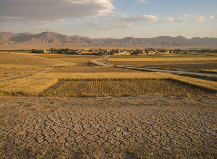
This distinction matters in Kabudarahang. The county lies in a semi-arid setting where groundwater is central to rural livelihoods. Excessive groundwater extraction can compact aquifer systems and cause the land surface to sink. Subsidence is particularly difficult to reverse because the physical structure of an aquifer can be permanently altered. At the same time, rural households still need reliable access to schools, health facilities, transport and other services. A planning framework that maps only one side of this problem risks directing resources toward symptoms while missing the process that is deepening vulnerability.
Thirteen indicators were combined into a spatial model
The researchers first used the Fuzzy Delphi Method to validate and weight 13 socio-spatial and environmental indicators. Fuzzy Delphi methods are designed to formalise expert judgement while allowing uncertainty in how experts rate the importance of different factors. Rather than treating every indicator as equally important, the procedure produces weights that reflect expert consensus.
Those 13 indicators were then integrated through multi-criteria spatial analysis and weighted overlay in a geographic information system. In practical terms, this allows several layers of disadvantage to be placed on the same map. Villages that are distant from key services can be compared with areas exposed to environmental hazards, while the weighting system determines how strongly each indicator contributes to the combined marginalisation pattern.
The researchers added a second analytical layer using system dynamics modelling in Vensim. This was important because a GIS map can identify where disadvantage is concentrated, but it does not by itself explain the feedback processes that may keep a place disadvantaged. System dynamics models are built around stocks, flows and feedback relationships. Here, the approach was used to represent how ecological degradation, livelihood pressure, service deprivation and rural isolation may interact rather than assuming that each operates independently.
The map revealed two different forms of isolation
The spatial analysis identified what the authors describe as a northern isolation zone. Its defining problem was service poverty. Residents faced excessively long distances to health and educational centres, meaning that marginalisation was closely tied to accessibility and the uneven territorial distribution of public services.
A different pattern emerged in the geological hazard zone. There, the central threat was not simply distance but the physical deterioration of the land itself. Subsidence rates exceeded 14 centimetres a year, and active sinkholes were present. For agricultural communities, this is more than a geological statistic. Ground deformation can damage farmland and infrastructure while groundwater depletion threatens the resource on which agricultural production depends.
The study’s central contribution is the connection between these layers. Environmental degradation can weaken agriculture-based livelihoods, reducing household and community resilience. Service deprivation can simultaneously increase the cost of education, healthcare and everyday mobility. The system dynamics analysis frames these interactions as vulnerability traps, in which one form of disadvantage can intensify another.
That does not mean every village follows an inevitable downward path. The model is a representation of interacting pressures, not a deterministic forecast for individual households. Its value is in showing why an environmental intervention and a service-delivery intervention may produce stronger results when planned together than when treated as unrelated programmes.
Land subsidence changes the governance problem
A subsidence rate above 14 centimetres per year gives the study a particularly urgent physical dimension. Public services can in principle be redistributed by building facilities, improving transport or decentralising delivery. Severe land subsidence is different because it signals stress in the underlying groundwater system and can progressively undermine the territory on which infrastructure and livelihoods depend.
The researchers therefore argue for equity-oriented territorial planning rather than a narrow infrastructure response. Their proposed direction combines more decentralised service distribution with immediate groundwater governance. The logic is straightforward: improving access to a clinic or school addresses one dimension of marginalisation, but if the local agricultural economy continues to deteriorate because of groundwater depletion and ground deformation, the wider vulnerability may persist.
Conversely, groundwater restrictions imposed without attention to household livelihoods and service access could create new pressures. Environmental governance can impose short-term adjustment costs on communities that depend heavily on groundwater-intensive agriculture. A spatially targeted approach allows planners to distinguish places where service access is the dominant problem from places where ecological risk is already undermining the economic base.
A useful framework, but not a household-level causal experiment
The study has several strengths. It integrates social and environmental information rather than reducing rural marginalisation to a single indicator. It also combines spatial mapping with system dynamics, allowing the researchers to move from identifying clusters of disadvantage toward examining plausible feedback structures. The use of 13 validated indicators makes the framework broader than a map based on one variable such as distance or income.
There are also important limits. The study is a regional spatial modelling exercise, not a randomised intervention or a longitudinal household experiment. It can identify co-located pressures and model feedback mechanisms, but it cannot prove that a specific amount of subsidence directly causes a particular household to migrate, lose income or stop using a service. Expert weighting through the Fuzzy Delphi Method also introduces judgement into the construction of the index, even though the method is designed to make that judgement systematic.
The results are also rooted in Kabudarahang County. The exact indicator weights, distances, groundwater conditions and institutional responses may not transfer directly to other rural regions. Replication elsewhere would be needed before treating the framework as universally calibrated. The authors’ broader methodological point is more portable: environmental stress and service deprivation should be analysed together when they overlap geographically and can reinforce one another.
What the findings mean for rural planning
The research suggests that rural inequality can become embedded in territory. Where public services are distant, residents carry a persistent accessibility burden. Where groundwater depletion is severe, the land and livelihood system itself can become less secure. Where both pressures occur together, conventional sector-by-sector planning may struggle because each intervention addresses only part of the feedback loop.
For policymakers, the practical implication is to prioritise spatially differentiated responses. Areas dominated by service poverty may benefit most from decentralised facilities, transport improvements or mobile service provision. Areas experiencing severe subsidence require groundwater management and livelihood adaptation alongside infrastructure planning. Places exposed to both need coordinated interventions that recognise environmental resilience as part of social equity.
The study therefore reframes marginalisation from a label attached to remote villages into a process that can be accelerated by environmental change. In Kabudarahang, a map of rural disadvantage is also a map of groundwater stress, geological risk and uneven access to basic services. That combination is precisely why the authors argue that regional resilience depends on planning for people and the physical landscape at the same time.
Source Information
Study: Spatial zoning of rural marginalization under environmental stress using geographic information systems and system dynamics
Authors: Shabnam Sadat Babamiri, Amirmasoud Amiran, Mozaffar Sarrafi and Hassan Mohammadian Mosammam
Journal: Scientific Reports
Published: 28 September 2026
DOI: 10.1038/s41598-026-73267-3
Study design: Integrated spatial modelling using 13 Fuzzy Delphi-validated socio-spatial and environmental indicators, GIS multi-criteria weighted overlay and system dynamics modelling in Kabudarahang County, Iran.