









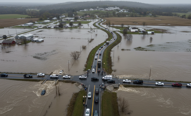
Flood evacuation plans have a difficult weakness: the safest route at the start of an emergency may become dangerous before people reach safety. Roads can disappear beneath rising water, bridges can become inaccessible and a route that looks shortest on a static map can direct evacuees towards the hazard rather than away from it.
Research published in Scientific Reports on 1 October 2026 tests a different approach. Instead of treating evacuation as a one-off shortest-path problem, the researchers developed a real-time heuristic flood evacuation path planning algorithm that repeatedly responds to simulated changes in inundation. In rural flood scenarios, the approach maintained more than 90% path availability and improved the accessibility of flood-protection routes by a factor of five compared with conventional alternatives.
A route has to remain safe while the flood moves
Traditional navigation algorithms are extremely effective when the road network is stable. Floods create a different optimisation problem because the network itself changes over time. Water depth can increase, previously passable links can become hazardous and the time at which an evacuee reaches a road segment matters almost as much as the segment’s location.
Xin Huang, Lin Tian, Youcan Feng and Donghe Ma built their Real-time Heuristic Flood Evacuation Path Planning Algorithm, or RHEPFA, around dynamic flood information produced by the ANUGA two-dimensional hydrodynamic model. Rather than relying only on distance, the routing process incorporates the evolving flood environment so that paths can be adjusted as hazards develop.
The framework considers several factors that can change the practical viability of evacuation, including dam-failure flooding, extreme weather, topography and population mobilisation rates. The objective is not simply to calculate the mathematically shortest path. It is to identify routes that can still get people to designated shelters while exposure conditions are changing.
The algorithm was tested against established routing approaches
The researchers evaluated RHEPFA against Dijkstra’s algorithm and an ant colony optimisation approach. Dijkstra’s algorithm is a widely used method for finding shortest paths through a network, while ant colony optimisation uses a population-based search process inspired by the way ants collectively identify efficient routes.
Those are useful benchmarks because flood evacuation exposes the limitation of optimising a route without sufficiently accounting for how quickly its conditions may deteriorate. A nominally efficient route is of little value if part of it is submerged by the time evacuees arrive.
Across the rural flood scenarios reported by the authors, RHEPFA improved the accessibility of flood-protection paths by a factor of five and maintained path availability above 90%. That result is important because availability measures whether a usable route continues to exist as inundation develops. The work therefore shifts the performance question from finding the shortest route at one instant to preserving access to safety over the course of the emergency.
Real-time routing changes what an evacuation map can do
Emergency evacuation maps are often prepared before an event. That remains essential for identifying shelters, vulnerable communities and major transport corridors, but pre-planning cannot anticipate every detail of a real flood. Rainfall intensity, infrastructure failure and the location and timing of inundation can all depart from the scenario used to design the original plan.
A dynamic routing system offers a complementary layer. Hydrodynamic forecasts can update the representation of the hazard, while the pathfinding system uses those updates to reconsider which links remain viable. In principle, that creates a feedback loop between what the water is doing and where people should move next.
The distinction becomes particularly important in extensive rural areas. Evacuation networks can contain relatively few alternative roads, meaning the loss of one connection may force a long detour or isolate a community entirely. Maintaining high path availability under those conditions can be more consequential than shaving a small amount of distance from the original route.
The South African relevance is practical
South Africa has repeatedly experienced destructive flooding in both dense urban areas and more dispersed settlements. The KwaZulu-Natal floods of recent years demonstrated how quickly roads, bridges and access routes can become unusable, while rural communities often face the additional problem of having fewer redundant transport links.
A system such as RHEPFA would not remove the need for drainage investment, resilient bridges, early-warning systems or well-located shelters. Its potential contribution sits between forecasting and operational response. If reliable flood forecasts can be translated rapidly into changing road-risk information, evacuation guidance can respond to conditions rather than assuming that the original route remains safe.
That also creates implementation requirements. Real-time routing is only as useful as the information feeding it. Flood models need sufficiently accurate rainfall, terrain and hydraulic data, while emergency authorities need a way to communicate route changes to people who may have limited connectivity or transport options. An algorithm can identify a safer path without guaranteeing that every evacuee can physically follow it.
Simulation performance is not the same as a live evacuation
The findings should therefore be interpreted as evidence about a computational evacuation method rather than proof of equivalent performance during a real disaster. The evaluation relies on simulated flood dynamics and routing scenarios. Human behaviour in emergencies can be less predictable than a model assumes: people may delay leaving, choose familiar roads, travel to relatives rather than designated shelters or encounter congestion and debris that are not represented perfectly in the underlying data.
Hydrodynamic forecasts also contain uncertainty. Small errors in predicted water depth or timing could affect whether a road is classified as usable. Communication delays create another practical challenge because a technically correct route update has little value if it reaches evacuees too late.
The study nevertheless demonstrates why evacuation routing increasingly needs to be treated as a dynamic problem. When the hazard itself is moving, the route to safety cannot always remain fixed. The strongest result is not simply that one algorithm found a different path. It is that incorporating changing flood conditions allowed usable routes to be preserved across more of the simulated emergency.
Source Information
Study Title: Real-time heuristic evacuation pathfinding algorithm for flood avoidance
Authors: Xin Huang, Lin Tian, Youcan Feng and Donghe Ma
Journal: Scientific Reports
Published: 1 October 2026
DOI: 10.1038/s41598-026-72197-4